Roads, trailer park gone; other areas escape damage
Days of heavy warm tropical-origin rain has fallen erratically across the Pacific Northwest, with mountain and coastal areas getting far more than the central lowlands. The uneven distribution of the rainfall showed with record flooding on some rivers, and little elsewhere. The Clackamas River rose to levels less than floods of of the past two years. The Willamette and Columbia, the two largest rivers of the region, saw only minor flooding. Elsewhere, especially on mid-sized rivers, the results were catastrophic.
Lee’s Camp, a mobile home park / resort on the Wilson River in the Coast Range mountains, was mostly washed away, with structures never before damaged now destroyed and trailers, some of them primary residences, floating off down the Wilson. This was record flooding. The Sandy River, which originates on Mount Hood, took out houses, and stranded a illegal campful of homeless men who had to be rescued. Higher up the mountain, near Zigzag, the Sandy removed parts of Lolo Pass Road.
Some of the most astounding flood effects came on the White River on the south side of Mount Hood. Like the Sandy, it heads in the glaciers high on the mountain. This makes both rivers subject to glacial outburst floods and generally higher flood levels due to snow and ice melt during these warm rains. Highway 35 at White River is now buried under grit, gravel and boulders of up to ten tons and more. The bridge over the river is still there but is buried and the river is to the east running in a new twenty foot deep channel. Its guesstimated that a million cubic yards of material was on the move in the White River Outwash Plain. The same highway near Pocket Creek Snowpark now has Clark Creek and Newton Creek both running down it. These two washouts has isolated Mount Hood Meadows Ski Resort from the outside world. Highway officials have set up plans for damage assessment but until this is done there is no telling how long repairs will take. Officials are hinting at the need for Federal dollars, which implies yet more time. And with winter snows just beginning, the timing could not be worse.
This is only the most recent of such outwash events at the White River crossing! This is the most rapidly eroding part of Mount Hood, where deep fragmental deposits are easily undercut and moved by the river. The first such event happened over eighty years ago, just a month after the highway first opened. A winter storm - in August! - hit the mountain and gave highway engineers their first taste of rebuilding at this spot. The wooden bridge was gone. Repeats of this occur about once a decade. To view a good source for pictures of this weeks damage from a local TV station, click here. Since this was posted yesterday, a good overview has been posted in a blog connected to Mount Hood Meadows by Dave Riley. Having toured all the washouts with officials, an informed report was possible, and pictures have been promised in the next day or so. Repairs are already underway on the Hood River approach, but the White River side will take more time.
Here is a link to a Google hybrid map of the area. A gray stripe of glacial outwash clearly shows crossing 35 south of Mount Hood, and the road is blocked from there to a point just north of the green arrow. Also to get an impression of the area, try a Google Earth search for "Highway 35, Mount Hood, OR". Rotate 180 degrees and follow highway 35 back. 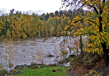
Flooding and Fall Color From Our Location
Elsewhere, the towns of Nehalem and Tillamook on the tourist-dependent Oregon Coast have a good deal of muddy flooding and some road damage. North in Washington State flooding, landslides, and washed away homes were widespread. The elk hunting season was in full swing and an unknown number of sportsmen are cut off by landslides and washed out roads. Official guesstimates are that a thousand are stuck in the woods with their vehicles. As many planned to stay in camp a week, not all are ready to be rescued. Some roads will be fixed quickly. Southern Oregon was out of the main storm path and has seen few problems.
Amid the sensationalism of news reports, remember the scattered nature of the flooding. While some spots did see record water levels, others were far from it and saw little or no damage, even for areas that often flood.
Thursday, November 09, 2006
Scattered Flooding in Pacfic Northwest
Subscribe to:
Post Comments (Atom)
No comments:
Post a Comment